The Florida Natural Areas Inventory is the central repository for information on Florida's conservation lands. The FNAI Conservation Lands database includes boundaries and statistics for more than 3,000 federal, state, local, and private managed areas, all provided directly by the managing agencies. National parks, state forests, wildlife management areas, local and private preserves are examples of the managed areas included.
For a property to be considered conservation land by the Florida Natural Areas Inventory (FNAI), a significant portion of the property must be undeveloped and retain most of the attributes one could expect it to have in its natural condition. In addition, the managing agency or organization must demonstrate a formal commitment to the conservation of the land in its natural condition. Our Conservation Lands FAQ explains the some of the other details about the database. Please address any further questions or concerns about the conservation lands databases to Nathan Pasco (email).
While we maintain ongoing data exchange with many federal and state agencies, local governments, and conservation non-profits, we encourage organizations to submit conservation lands information for our database. We need a few specific pieces of information about each managed area and boundaries for each managed area. To submit information on managed areas, please download and complete this data collection form. Boundaries are best submitted in a GIS shapefile/feature class, but if that is unavailable, a list of the parcel ID’s involved and/or a detailed map will usually suffice.
Alternatively, if ArcGIS capabilities are available, you can download this empty ArcGIS feature class template and provide the boundaries already connected to same information as you would in the data collection form. Please send all completed materials to Nathan Pasco.
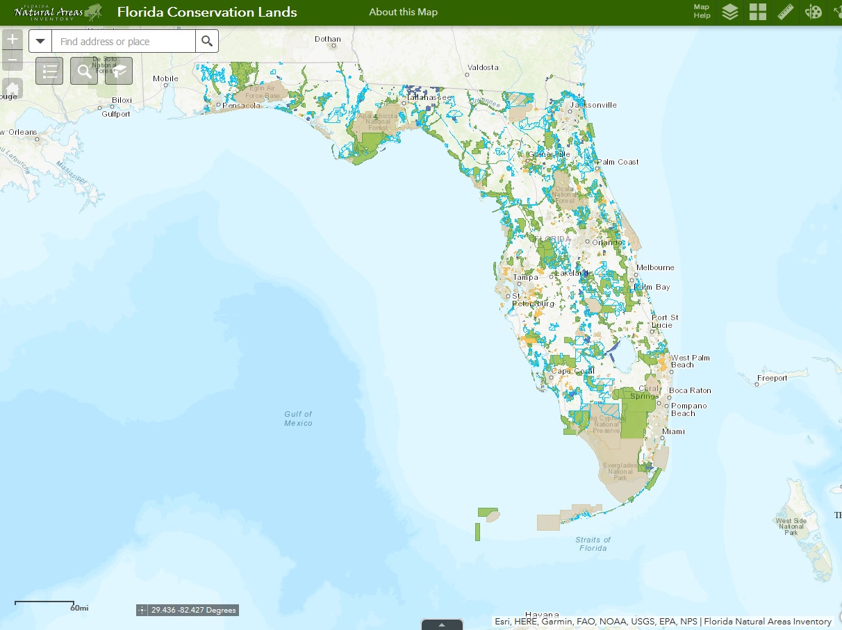
View and interact with Conservation Lands, Florida Forever Projects, Florida Forever Acquisitions, and Conservation Easements in a single map.
Click the map image to launch the map or here
For tips and instructions on using map tools click "map help" at the top of the map. Not all conservation lands are open to the public; contact managing agency for additional information.
The Florida Natural Areas Inventory is the primary source for information on Florida's conservation lands. Each year FNAI compiles a definitive summary report on the acreage of conservation lands by managing agency, including Less-Than-Fee lands.


© 2020-2026 - Florida Natural Areas Inventory. We follow Florida State University's Privacy Policy
