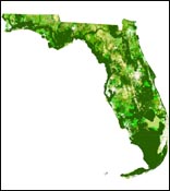
In 2006, the Century Commission for a Sustainable Florida called for an identification of those lands and waters in the state that are critical to the conservation of Florida's natural resources. In response, the Florida Natural Areas Inventory, University of Florida Center for Landscape Conservation Planning, and Florida Fish & Wildlife Conservation Commission collaborated to produce CLIP - the Critical Lands and Waters Identification Project. CLIP is a GIS database of statewide conservation priorities for a broad range of natural resources, including biodiversity, landscape function, surface water, groundwater, and marine resources. CLIP is now being used to inform planning decisions by the Peninsular Florida Landscape Conservation Cooperative, coordinated by the U.S. Fish and Wildlife Service.

CLIP Version 4.0 was completed in August 2016. CLIP data may now be downloaded for use in GIS, see below.
Download CLIP 4.02 GIS data CLIP GIS database (ESRI raster layers), 470mb zipped file.
CLIP 4.0 User Tutorial 3mb pdf - this is a brief graphic tutorial of the CLIP 3.0 database to assist users who plan to download and use CLIP GIS data. It provides a quick preview to the data and important analysis issues. We highly recommend all GIS users review this tutorial before working with CLIP data. (The tutorial is also included in the data download package.)
CLIP 4.0 Technical Report 7mb pdf - this report provides full documentation of the CLIP 4.0 updates and additional analyses conducted by the CLIP team as part of our contract with the U.S. Fish and Wildlife Service.
Many of the natural resource data layers included in CLIP were derived from the Florida Forever Conservation Needs Assessment developed by FNAI to support the Florida Forever program.
CLIP is also being used to inform the Cooperative Conservation Blueprint, a statewide conservation planning effort led by the Florida Fish & Wildlife Conservation Commission. The Blueprint is a key action called for in the FWC Wildlife Legacy Initiative.