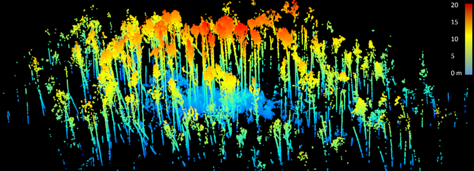
FNAI scientists’ extensive personal knowledge of Florida's natural history coupled with our skills in quantitative analysis allow us to address complex management questions concerning the interaction of rare species with their habitats.
Examples:
FNAI is sampling vegetation in dunes occupied by beach mice on Tyndall Air Force Base and the St. Joe Peninsula to assess the relationship between vegetative structure and composition and mouse occupancy levels.
FNAI is establishing Reference Natural Community sites for priority community types to inform the standardization of Florida's Uniform Mitigation and Assessment Method (UMAM). Our quantitative characterization of these sites will help to determine the appropriate range of values/conditions for the ecological concepts in the Community Structure section of UMAM.
A ground based lidar point cloud of a wet flatwoods longleaf pine (Pinus palustris) stand at Tyndall Air Force Base. The color gradient represents the height of returns in meters. We generated the image using the TreeLS package in R. Generating millions of points in a matter of minutes, we can use these point clouds to quantify stand structure, allowing for a more efficient, precise, and objective alternative to traditional visual estimates. Ground-based lidar has numerous applications including assessing plant community composition, species richness and diversity, wildlife habitat characteristics, and monitoring forest changes following disturbance events such as wildfires, hurricanes, and tornadoes.